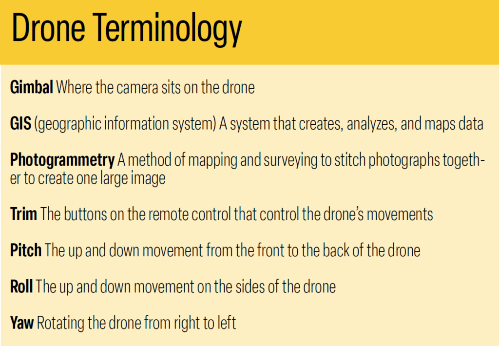
Drones Take to the Skies
How these small machines increase efficiency and reduce risk in tree care work
From seedling inventory to mapping and marketing, unmanned aerial vehicles (UAVs) are pulling their weight in the forestry and tree care industries


Este es nuestro intento de convertir las historias en audio español usando Inteligencia Artificial. Aún así le recomendamos que reconfirme ciertas palabras clave y temas. ArborTIMES no garantiza ni se responsabiliza de la conversión del inglés al español de los relatos.
For more than a century, technology and tree care have grown together. From portable chainsaws to sophisticated machinery, the tree care and forestry industries are constantly seeking new and novel advancements to save time, money, and effort.
When it comes to monitoring tree health, conducting inspections and surveys, and improving employee safety measures, many companies are adopting unmanned aerial vehicles (UAVs), also known as drones, into their current operations.
“Drones have many uses in the forestry and tree care industry,” says Sean Henry, a research technician and media and audio-video support specialist with Bartlett Tree Experts. “From tree health care to invasive insect detection to general mapping and imagery, drones are quickly making their way more and more into the corporate world.”
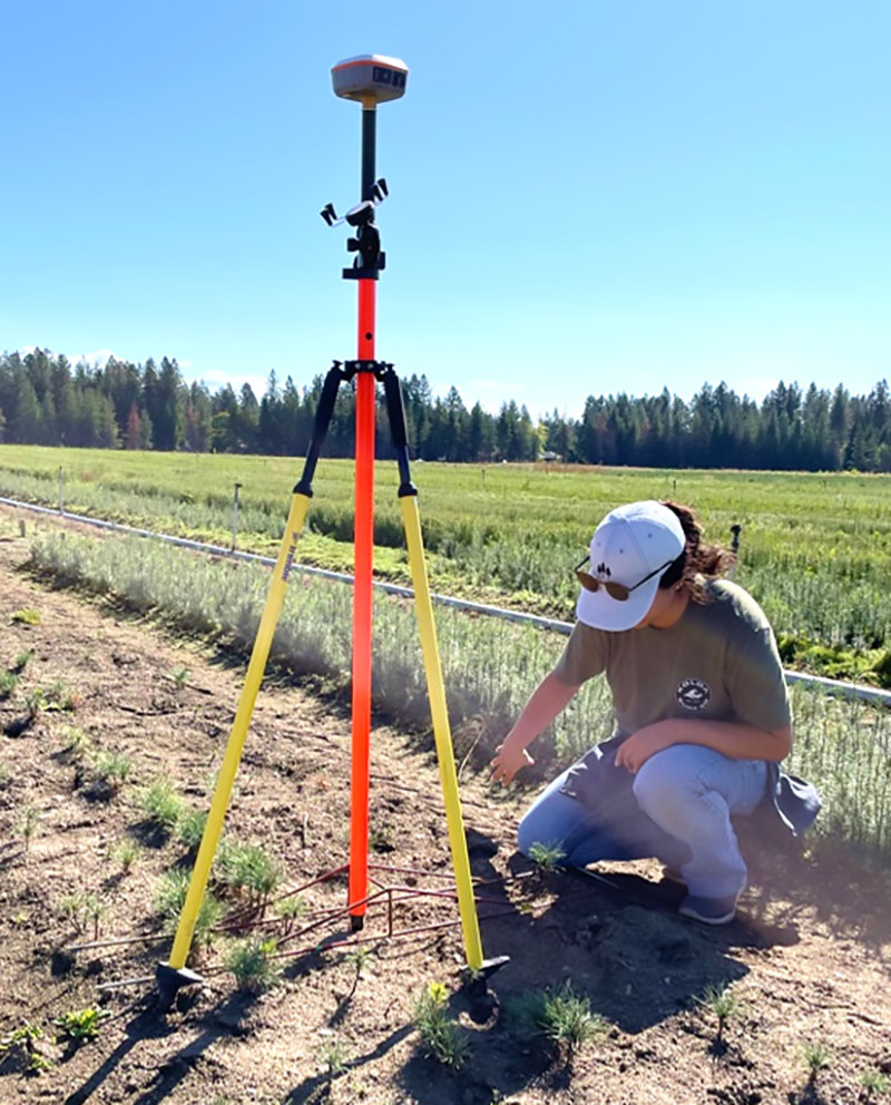
In forestry work, drones are used to address a reforestation backlog, primarily caused by wildfires. Analysts use drones to conduct seedling inventories to ensure production goals are being met and to check on the value of regeneration across national forests.
“This work has always been done manually,” says Olivia Fraser, a national reforestation and nursery systems analyst with the US Department of Agriculture Forestry Service (USDA.) “It’s really time-consuming and physically demanding. The use of drones makes this more efficient and helps us increase capacity.”
Considering adding a drone to your tree care toolkit? Here’s what you need to know about this small, but mighty, flying machine.
Drones on the rise
Although drones are often thought to be a new and modern technological advancement, aerial vehicles have been in existence for quite some time. Dating back to the early 1900s, aerial vehicles were used by the USDA and US military for agriculture purposes, such as crop dusting, seed spreading, and crop protection.
Later, UAVs and camera drones were introduced. In the 1980s, research was conducted on weeds found in oilseed crops, using aerial imagery from a camera strapped to a drone.
Fast forward to the 21st century, drones have made quite an impact on the agriculture and tree care industries. It wasn’t until the 2000s that access to flying camera drones became more accessible. Today, drones can perform tasks such as tree inspections, pest and disease identification and management, collecting and monitoring real-time data, and surveying and mapping.
“The first DJI Phantom drone was available for purchase about 20 years ago,” says Keith Brown, founder and owner of Austin Tree Experts. “Initially, drones were used to fly utility lines and for basic management purposes. Now, the technology has advanced to include high-definition cameras for imagery and video, as well as LiDAR (light detection and ranging) and vegetation indexing.”
The agriculture drone market was estimated at $347.9 million in 2022 and is expected to grow at a compound annual growth rate of 22.8% from 2023 to 2030, according to industry research by Grand View Research.
Types of drones
Drones are typically categorized as fixed-wing or rotary-wing.
Fixed-wing drones look and fly like an airplane. They have two fixed wings on either side and are considered more energy-efficient than rotary-wing drones. They can cover large amounts of land and are great for surveying and agricultural uses.
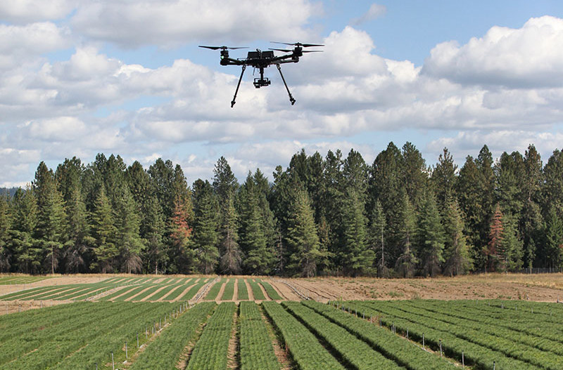
Rotary-wing drones, also known as rotorcraft, are manufactured with rotary wings or rotor blades. They have hovering capabilities and are considered easier to maneuver through dense forests. The rotary-wing drone is often the go-to for commercial tree care uses.
“For small- to medium-sized tree care businesses working in residential neighborhoods and urban areas, the rotary-wing DJI Mini 4 Pro is a great choice,” says Henry. “There are many drone companies on the market, but DJI makes a really good product and is most widely used in the tree care industry.”
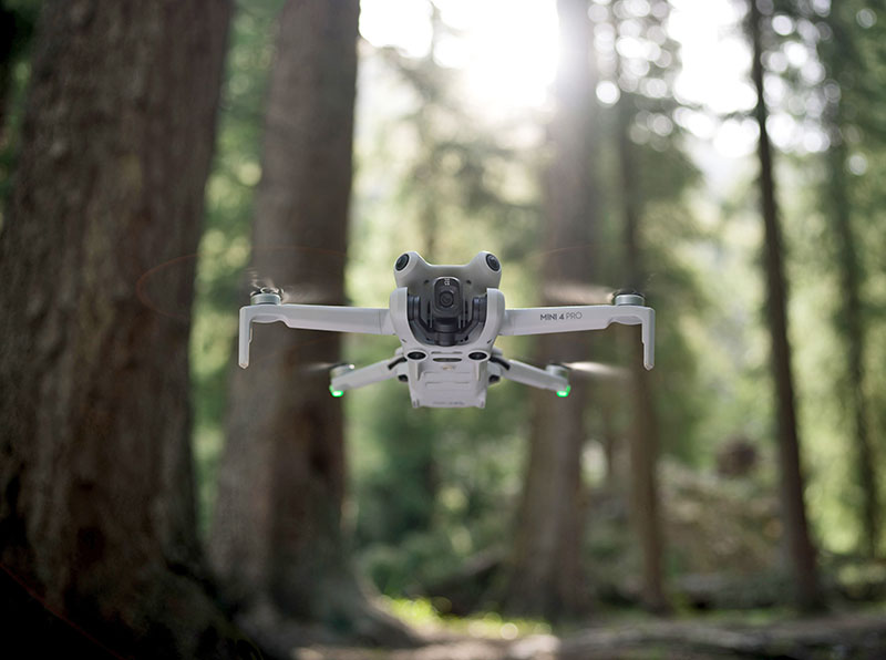
The DJI Mini 4 Pro is a lightweight, convenient option for new and seasoned flyers. Because it weighs less than 249 grams, some FAA restrictions may not apply to its use.
Due to its small size, this drone can fly up to 35 mph and comes equipped with a high definition, 4k image camera. Additional features include large-angle tilt, digital zoom, longer battery life, and obstacle sensors with automatic braking, great for avoiding limbs and reducing crashes.
At a price of around $1,000, the DJI Mini 4 Pro is great for quick tree assessments, aerial imagery for mapping and surveying, and simple, quick video and image capture for consulting services, management planning, and marketing.
For larger commercial businesses, or for those looking to take on projects that require a more durable drone, Henry recommends the DJI Matrice 350 RTK.
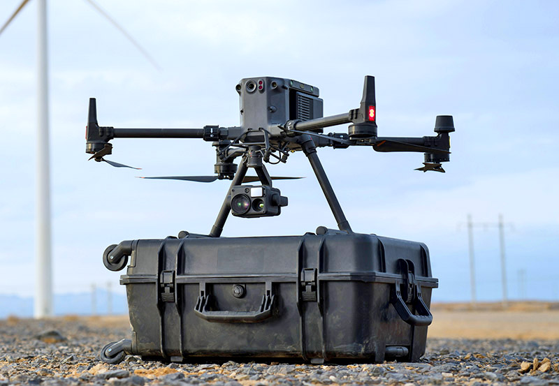
“The DJI Matrice is used for larger projects such as spraying, insect releases, pruning and even sampling for disease and pests,” says Henry. “It’s a bit more expensive than others … but it is capable of lifting heavier items and you can add additional controls to it.”
A heftier investment at around $12,000, the Matrice can reach speeds up to 50 mph and can be used to lift items up to six pounds. This can include tanks of pesticides for spraying, boxes of predator bugs for release, and equipment for pruning trees. With more bells and whistles, this drone is also capable of taking samples from trees for disease and pest assessments.
Brown agrees that DJI drone products are the best on the market. “When it comes to using drones for business, DJI was and still is the product of choice,” he explains. “The cameras are pretty good, which helps with mapping and management planning.”
DJI, a Chinese company, dominates the drone market. Commanding an astounding 80% of the American market and 60% of the global market, it’s easy to see that DJI is a popular choice.
The USDA Forest Service uses a wide range of drones to conduct its work. These range from small, foldable devices used to conduct assessments or measure hot spots during wildfires to larger versions with payloads that can carry up to 35 pounds. These are used to carry the chemicals needed to conduct prescribed burns.
Drone add-ons
In addition to the drone, specialized technology and software can be purchased to enhance its capabilities. If not already equipped, a high-definition camera, like a Go-Pro, will be needed for capturing aerial imagery.
“The newer DJI Air 2S drone does most of what I need it to,” says Brown. “The Air 2S or the mini drones, can maneuver around limbs and trees and often are equipped with high-quality cameras. So, you’ll either need to buy a camera drone or buy the drone and mount a camera to it.”
The Parrot Sequoia multispectral camera is a top-notch option for drones, according to Henry. This type of camera is useful for capturing different bands of the light spectrum that the human eye can’t see.
“This specialized camera is worth more than two or three drones put together,” says Henry. “It’s expensive, but it takes multispectral shots, taking five or more pictures at a time, and is compatible with all types of drones.”
The USDA uses multispectral cameras to detect vegetation health. It also uses light detection and ranging cameras (LiDAR) to measure forests.
“It’s an active sensor used to measure things in 3D to collect high-resolution data for the area we are modeling,” says Adam Clark, a remote sensing specialist at the USDA’s Geospatial Technology and Application Center. While helicopters usually conducted LiDAR work, drones have slowly taken over this task.
To operate a drone, a remote control is also needed.
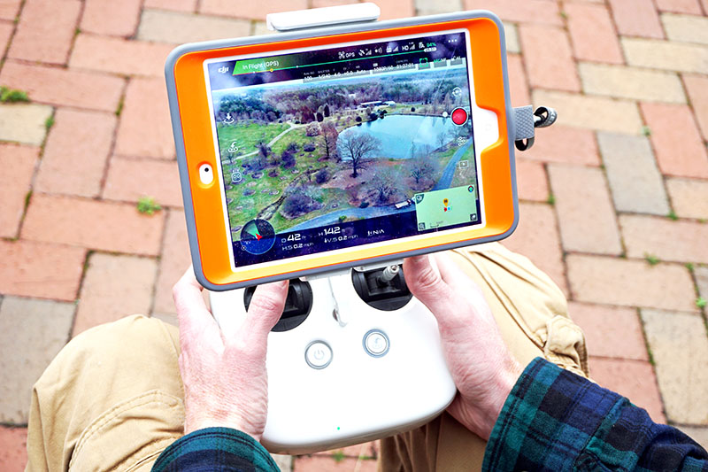
“For most drones, you’ll need to purchase the smart controller separately,” says Henry. “Basic controllers can be used with a smartphone. But for a few hundred dollars, the smart controller can give you more options, including a screen display.”
To use the imagery and video obtained by the drone, proper software and applications are needed as well.
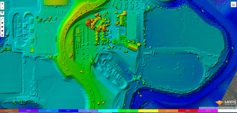
“For mapping jobs, drones need the right software,” explains Brown. “Software like Maps Made Easy can be used on iOS or Android to easily draw a box around an area for the drone to fly. The drone goes up, flies the predetermined flight path, gives real-time feedback, and captures imagery that is later stitched into a larger map.”
Drones at work
In forestry work, drones help conduct wildfire management by providing awareness of hot spots and fire perimeters. They are also used to ensure that seedling inventories at the USDA’s six national nurseries are meeting the demand of the agency’s reforestation efforts.
“What we would be using UAVs for is flying over these seedling lots and using cameras to recreate the lot in 3D and create a map of the area,” says Clark.
The USDA is quick to point out that drones have their limits.
“One thing we often say is that UAVs are not the solution for everything,” says Fraser. “It may be efficient, but it’s not going to replace people on the ground doing that work.”
For the average tree care company, drones capture data and aerial imagery that can be used to give clients comprehensive insights and analysis.
Surveying and mapping
Drone software uses aerial imagery to stitch together a larger image, creating a map of a specific area. These maps can be used to detect power lines in dense forests, show historical and real-time changes of an area, and for taking tree inventory.
Tree inspections
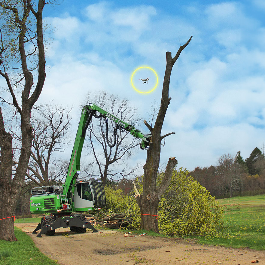
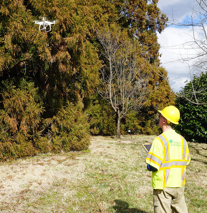
Tree inspections are possibly the most common application for drones. A drone can fly above the crown of the tree to inspect for diseases and pests. This also eliminates the risk of falls or injury from tree climbing and reduces the need for bucket trucks.
Although useful, some challenges can affect aerial tree inspections. For example, dense canopies may prevent the drone from taking up-close quality imagery. Also, high winds can blow the drone around, making it difficult for the operator to fly. Manufacturers are working to resolve this issue with stabilizing technology.
“Sometimes the leaves on the trees shade the tree,” says Brown. “This affects the lighting on the interior of the canopy. With taking drone imagery, timing is everything.”
Pruning and sampling
Some of the larger commercial drones can be used to prune and maintain trees. Additionally, tree samples can be extracted by the drone and brought back for research and assessments.
“At the University of California, Berkeley, research was being conducted using a drone with an automated clipper on it to take samples of a tree,” explains Henry. “On the other side of the world, England researchers were looking for a type of fungus growing on the sycamore trees there. The drone flew up, clipped a piece of the tree, then landed. This could help tree care professionals find and treat diseases rather quickly.”
Agriculture applications
As technology advances, specialized sensors are entering the scene to provide accurate and detailed information about tree health.
“LiDAR technology has a lot of potential,” says Henry. “It’s a special sensor-based technology used to see through the forest’s canopy. LiDAR is used to create incredible colorized maps that show the trees in 3D. It can also show temperature differences and detect tree stress.”
Another up-and-coming technology is known as normalized difference vegetation index (NDVI.) This advanced remote sensing measures the health of present vegetation based on how the plants reflect light.
Management plans
Drones can provide a high-level communication tool for tree care specialists to use during consulting jobs.
“The drone takes a series of photos and stitches them together,” says Brown. “Instead of assessing individual trees, drone imagery provides an averaging. From this, information gathered can be used to make informed decisions about applications such as fertilization and pesticides, for example.”
Marketing
Drone images and videos can be used to discuss tree care decisions with clients. These can also be used to support a company’s marketing effort. Posting regular videos on a website, blog, or social media platform is a great way to show potential clients how tree care work is performed.
Before you buy
The use of drones is an exciting addition to the list of services tree care companies can offer. It can provide a cost-effective solution to often laborious tasks, as drones eliminate risk and increase efficiency.
“You can spend a few hundred dollars and buy a quality drone for your business,” explains Henry. “But be aware, however, that flying for money, no matter what drone you purchase, you still need to get a pilot’s license and follow all of the FAA (Federal Aviation Administration,) state, and often municipality, rules, and guidelines.”
Here are a few things to consider before and when buying a drone.
Licensing To fly a drone for commercial purposes, an operator must be certified. To become a certified remote pilot, there are other FAA conditions that need to be met. A pilot must be at least 16 years of age, fluent in English, pass an aeronautical knowledge exam, and be in good physical and mental condition to fly a drone.
Remote ID All drones that weigh more than 249 grams and are used for commercial purposes must be registered with the FAA. The cost to register is $5 per drone and is valid for three years.
After registering, a certificate is issued and must be in the possession of the pilot while flying. In addition, all drones must be labeled with their corresponding registration number before they are cleared for flying.
Henry says a remote ID is like the license plate on a car. “The identification number needs to be visible,” he says. “The easiest way is to use a paint marker and write the number on the drone.”
Local regulations In addition to federal requirements, each state has its own laws and regulations for flying drones. Common restrictions include flying near stadiums and sporting events, airports and hospitals, over large groups of people, emergency or rescue operations, and other restricted or special-use airspace as outlined by the FAA.
But even in highly restricted airspace, requests may be granted in certain circumstances.
“Drone operators need to research the class of airspace they plan to fly in,” says Henry. “For example, Class B airspace is highly restricted, while Class G airspace is fairly open. In restricted airspace, you can request permission to fly, but that’s not always guaranteed. Download the B4UFly app from the FAA. It makes requesting flight in restricted airspace much easier.”
Line of sight: Drones can fly up to 400 feet above the ground and must be within one’s visual line of sight (VLOS). That means the operator can see the drone without the need for binoculars or special equipment. This rule is essential to keeping drones out of the flight path of airplanes and other aircraft. Special flights that exceed 400 feet require a waiver from the FAA.
Insurance
Many commercial insurance policies do not include drone coverage. While insurance is not currently mandatory, it is highly recommended. A general liability insurance policy may cover accidents related to drone use.
Owners and operators should regularly visit the FAA’s website to stay up to date on all of the licensing and regulations as they apply to commercial drone use.
Final thoughts
Using a drone in your tree care operation offers many advantages. From providing accurate real-time data and imagery to advanced tree health assessments and applications, it’s easy to understand and accept drones as a useful tree care management tool.
Drones are proving to be cost-effective, efficient, and are eliminating some of the risks associated with the tree care industry. Tapping into this technology could give your company a competitive advantage.
Popular Drone Manufacturers
These companies make drones and add-ons commonly used within the tree care industry.